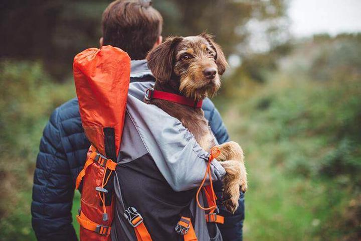
There’s 1 dog-friendly hiking trail in Latrobe, and 22 more nearby. Use the links below to get an overview of each one, see pictures, print directions, and even read reviews from other dog owners. Coming from out of town? Get a discounted rate on pet friendly hotels in Latrobe.
Twin Lakes Park
Visit the pet-friendly Twin Lakes Park in Latrobe, PA. This community recreation area features the off-leash Franklin Dog Park, gorgeous lakes, dog waste stations and walking trails to explore with Fido. Pups must be leashed at all times when not in the dog park.
See Details
PWS Trail System
The PWS Trail System is one of 1600 rail-trails supported by Rails-to-Trails Conservancy, a nonprofit organization that is working to create a nationwide network of trails from former rail lines and connecting corridors. Previously an unused railroad corridor, this "rail-trail" is now a great place to walk Fido in Somerset! The map below shows a parking area with convenient access to the PWS Trail System. Rails-to-Trails Conservancy has generously provided map data for this trail to Bring Fido for informational purposes only. For more detailed trail information, please visit TrailLink.com.
See Details
Hoodlebug Trail
The Hoodlebug Trail is one of 1600 rail-trails supported by Rails-to-Trails Conservancy, a nonprofit organization that is working to create a nationwide network of trails from former rail lines and connecting corridors. Previously an unused railroad corridor, this "rail-trail" is now a great place to walk Fido in Indiana! The map below shows a parking area with convenient access to the Hoodlebug Trail. Rails-to-Trails Conservancy has generously provided map data for this trail to Bring Fido for informational purposes only. For more detailed trail information, please visit TrailLink.com.
See Details
Lillian Kellman Nature Reserve
Leashed dogs are welcome at the pet-friendly Lillian Kellman Nature Reserve in Murrysville, PA. This 56-acre wooded park features tons of beautiful trails for you and Fido to explore.
See Details
Great Allegheny Passage
The Great Allegheny Passage is one of 1600 rail-trails supported by Rails-to-Trails Conservancy, a nonprofit organization that is working to create a nationwide network of trails from former rail lines and connecting corridors. Previously an unused railroad corridor, this dog-friendly "rail-trail" is now a great place to walk Fido in Connellsville! The map below shows a parking area with convenient access to the Great Allegheny Passage. Rails-to-Trails Conservancy has generously provided map data for this trail to Bring Fido for informational purposes only. For more detailed trail information, please visit TrailLink.com.
See Details
Coal & Coke Trail
The Coal & Coke Trail is one of 1600 rail-trails supported by Rails-to-Trails Conservancy, a nonprofit organization that is working to create a nationwide network of trails from former rail lines and connecting corridors. Previously an unused railroad corridor, this "rail-trail" is now a great place to walk Fido in Mount Pleasant! The map below shows a parking area with convenient access to the Coal & Coke Trail. Rails-to-Trails Conservancy has generously provided map data for this trail to Bring Fido for informational purposes only. For more detailed trail information, please visit TrailLink.com.
See Details
Five Star Trail
The Five Star Trail is one of 1600 rail-trails supported by Rails-to-Trails Conservancy, a nonprofit organization that is working to create a nationwide network of trails from former rail lines and connecting corridors. Previously an unused railroad corridor, this "rail-trail" is now a great place to walk Fido in Greensburg! The map below shows a trailhead where you can pick up the Five Star Trail. Rails-to-Trails Conservancy has generously provided map data for this trail to Bring Fido for informational purposes only. For more detailed trail information, please visit TrailLink.com.
See Details
Roaring Run Trail
The Roaring Run Trail is one of 1600 rail-trails supported by Rails-to-Trails Conservancy, a nonprofit organization that is working to create a nationwide network of trails from former rail lines and connecting corridors. Previously an unused railroad corridor, this "rail-trail" is now a great place to walk Fido in Apollo! The map below shows a trailhead where you can pick up the Roaring Run Trail. Rails-to-Trails Conservancy has generously provided map data for this trail to Bring Fido for informational purposes only. For more detailed trail information, please visit TrailLink.com.
See Details
Westmoreland Heritage Trail
The Westmoreland Heritage Trail is one of 1600 rail-trails supported by Rails-to-Trails Conservancy, a nonprofit organization that is working to create a nationwide network of trails from former rail lines and connecting corridors. Previously an unused railroad corridor, this "rail-trail" is now a great place to walk Fido in Apollo! The map below shows a trailhead where you can pick up the Westmoreland Heritage Trail. Rails-to-Trails Conservancy has generously provided map data for this trail to Bring Fido for informational purposes only. For more detailed trail information, please visit TrailLink.com.
See Details
Coal & Coke Trail
The Coal & Coke Trail is one of 1600 rail-trails supported by Rails-to-Trails Conservancy, a nonprofit organization that is working to create a nationwide network of trails from former rail lines and connecting corridors. Previously an unused railroad corridor, this "rail-trail" is now a great place to walk Fido in Scottdale! The map below shows a parking area with convenient access to the Coal & Coke Trail. Rails-to-Trails Conservancy has generously provided map data for this trail to Bring Fido for informational purposes only. For more detailed trail information, please visit TrailLink.com.
See Details
Westmoreland Heritage Trail
The Westmoreland Heritage Trail is one of 1600 rail-trails supported by Rails-to-Trails Conservancy, a nonprofit organization that is working to create a nationwide network of trails from former rail lines and connecting corridors. Previously an unused railroad corridor, this "rail-trail" is now a great place to walk Fido in Saltsburg! The map below shows a trailhead where you can pick up the Westmoreland Heritage Trail. Rails-to-Trails Conservancy has generously provided map data for this trail to Bring Fido for informational purposes only. For more detailed trail information, please visit TrailLink.com.
See Details
Indian Creek Valley Bike Trail
The Indian Creek Valley Bike Trail is one of 1600 rail-trails supported by Rails-to-Trails Conservancy, a nonprofit organization that is working to create a nationwide network of trails from former rail lines and connecting corridors. Previously an unused railroad corridor, this "rail-trail" is now a great place to walk Fido in Normalville! The map below shows a parking area with convenient access to the Indian Creek Valley Bike Trail. Rails-to-Trails Conservancy has generously provided map data for this trail to Bring Fido for informational purposes only. For more detailed trail information, please visit TrailLink.com.
See Details
Five Star Trail
The Five Star Trail is one of 1600 rail-trails supported by Rails-to-Trails Conservancy, a nonprofit organization that is working to create a nationwide network of trails from former rail lines and connecting corridors. Previously an unused railroad corridor, this "rail-trail" is now a great place to walk Fido in Youngwood! The map below shows a trailhead where you can pick up the Five Star Trail. Rails-to-Trails Conservancy has generously provided map data for this trail to Bring Fido for informational purposes only. For more detailed trail information, please visit TrailLink.com.
See Details
Indian Creek Valley Bike Trail
The Indian Creek Valley Bike Trail is one of 1600 rail-trails supported by Rails-to-Trails Conservancy, a nonprofit organization that is working to create a nationwide network of trails from former rail lines and connecting corridors. Previously an unused railroad corridor, this "rail-trail" is now a great place to walk Fido in Melcroft! The map below shows a parking area with convenient access to the Indian Creek Valley Bike Trail. Rails-to-Trails Conservancy has generously provided map data for this trail to Bring Fido for informational purposes only. For more detailed trail information, please visit TrailLink.com.
See Details
PWS Trail System
The PWS Trail System is one of 1600 rail-trails supported by Rails-to-Trails Conservancy, a nonprofit organization that is working to create a nationwide network of trails from former rail lines and connecting corridors. Previously an unused railroad corridor, this "rail-trail" is now a great place to walk Fido in Stahlstown! The map below shows a parking area with convenient access to the PWS Trail System. Rails-to-Trails Conservancy has generously provided map data for this trail to Bring Fido for informational purposes only. For more detailed trail information, please visit TrailLink.com.
See Details
Indian Creek Valley Bike Trail
The Indian Creek Valley Bike Trail is one of 1600 rail-trails supported by Rails-to-Trails Conservancy, a nonprofit organization that is working to create a nationwide network of trails from former rail lines and connecting corridors. Previously an unused railroad corridor, this "rail-trail" is now a great place to walk Fido in Indian Head! The map below shows a parking area with convenient access to the Indian Creek Valley Bike Trail. Rails-to-Trails Conservancy has generously provided map data for this trail to Bring Fido for informational purposes only. For more detailed trail information, please visit TrailLink.com.
See Details
West Penn Trail
The West Penn Trail is one of 1600 rail-trails supported by Rails-to-Trails Conservancy, a nonprofit organization that is working to create a nationwide network of trails from former rail lines and connecting corridors. Previously an unused railroad corridor, this "rail-trail" is now a great place to walk Fido in New Alexandria! The map below shows a trailhead where you can pick up the West Penn Trail. Rails-to-Trails Conservancy has generously provided map data for this trail to Bring Fido for informational purposes only. For more detailed trail information, please visit TrailLink.com.
See Details
PWS Trail System
The PWS Trail System is one of 1600 rail-trails supported by Rails-to-Trails Conservancy, a nonprofit organization that is working to create a nationwide network of trails from former rail lines and connecting corridors. Previously an unused railroad corridor, this "rail-trail" is now a great place to walk Fido in Boswell! The map below shows a parking area with convenient access to the PWS Trail System. Rails-to-Trails Conservancy has generously provided map data for this trail to Bring Fido for informational purposes only. For more detailed trail information, please visit TrailLink.com.
See Details
Hoodlebug Trail
The Hoodlebug Trail is one of 1600 rail-trails supported by Rails-to-Trails Conservancy, a nonprofit organization that is working to create a nationwide network of trails from former rail lines and connecting corridors. Previously an unused railroad corridor, this "rail-trail" is now a great place to walk Fido in Homer City! The map below shows a parking area with convenient access to the Hoodlebug Trail. Rails-to-Trails Conservancy has generously provided map data for this trail to Bring Fido for informational purposes only. For more detailed trail information, please visit TrailLink.com.
See Details
West Penn Trail
The West Penn Trail is one of 1600 rail-trails supported by Rails-to-Trails Conservancy, a nonprofit organization that is working to create a nationwide network of trails from former rail lines and connecting corridors. Previously an unused railroad corridor, this "rail-trail" is now a great place to walk Fido in Blairsville! The map below shows a parking area with convenient access to the West Penn Trail. Rails-to-Trails Conservancy has generously provided map data for this trail to Bring Fido for informational purposes only. For more detailed trail information, please visit TrailLink.com.
See Details
There are no dog friendly activities matching your query. Try changing your search options.
{{/results}}
Fetching results…
Unable to load dog friendly activities.
See more…
{{#found}}
{{/found}}
See more…
{{#found}}
{{/found}}
Up to date
{{#error}}
{{error}}
{{#unverified}}
To resend the verification email, click here.
{{/unverified}}
{{/error}}
{{#error}}
{{error}}
{{#duplicate}}
If you forgot your password, you can
.
{{/duplicate}}
{{#unverified}}
To resend the verification email, click here.
{{/unverified}}
{{/error}}
{{#error}}
{{error}}
{{/error}}
{{^error}}
We’ve emailed you instructions for resetting your password. If you don’t receive an email, please make sure you entered the correct address and check your spam folder.
{{/error}}
Your Privacy
We use cookies to deliver our services, personalize content, and get feedback on how people use BringFido so that we can improve.
By clicking OK, you accept this as outlined in our Cookie Policy.